|
Hi all, I've been working on a research project where I'm examining the impacts of a type of facility on local economic and health outcomes. I have a great database of where these facilities are located. However, the timing of when they came on the map, so to speak, is limited. I don't have much confidence that the dates are meaningful (e.g., they may be re-authorizations for operations rather than initial authorizations). I've been going back and forth trying to download historical imagery from EarthExplorer, etc., but it appears that the EarthExplorer database (among others) have limited ability to either (1) download data in bulk for hundreds of facilities (in my case, I have ~1,000 points where I'd like to grab aerial imagery from); and (2) download data across time. Ideally, I'd like a database of images of each place at each point of time available and then create an image classification algorithm to identify when these facilities "came on the map". I'm new to Collect Earth. Does it sound like Collect Earth could be a valuable tool in this type of project? Sincerely, Andy |
|
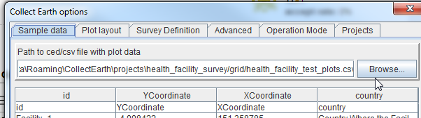
Dear Andy, In Collect Earth you are able to access the whole imagery dataset of Landsat and Sentinel-2 (ESA's open imagery at 10 meter resolution from 2014) thanks to the integration with Google Earth Engine (a cloud based service offered by Google for research and non-commercial activities ). As we use Google Earth as the interface for the data collection one can also use the historical Very High Resolution Imagery that is available there in order to understand changes in the land ( see the clock-like icon on the top menu of Google Earth ). If you are lucky and you are collecting data close to settlements there will be a few images you can use. I would not recommend you to create classified images for change detection as this is quite complicated to do and the results will be pretty uncertain. I have created a test survey for you to test. Of course you need to first install Google Earth Pro, Collect Earth and Chrome or Firefox on your computer. This is a very simple survey ( LINK TO DOWNLOAD) where you can say if you can identify the facility Now, in this survey there are 15 random test plots. If you want to use your own list of plots with the facilities you have already identified you must create a CSV file with these columns: id,latitude,longitude,country the current CSV looks like this Once you have created this CSV, you need to go to Collect Earth top menu Tools->Properties and where it says "Path to csv/ced with plot data" choose the new CSV you created.
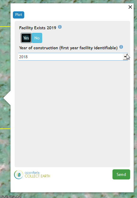
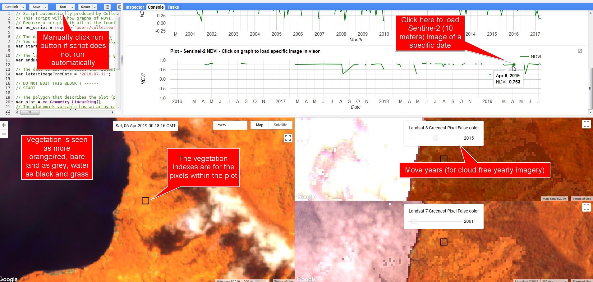
For the data collection: when you click on a plot, you will get the pop-up window where you can fill the data for the survey (in this case super-simple) and three more window with open with Bing Maps and Google Earth Engine (you need to have signed up to Google Earth Engine here : https://signup.earthengine.google.com ) In the Google Earth Engine window you will be able to see Landsat 7/8 Imagery (from 2000) and Sentinel-2 (from 2014). You can use the sliders in the Landsat window to see image mosaics for different years, or you can click directly on the vegetation graph of Sentinel-2 to visualize imagery for single dates. Please see screenshot at the bottom of post for explanation of the GEE window. If you want to edit or create a different survey you need to install Open Foris Collect, an application that allows you to design surveys and handle data on a central server) . Please follow these videos: Installing Collect : https://www.youtube.com/watch?v=z7TnZnWzZ2w Importing and editing a survey (you can use the one I created as a base for further development): https://www.youtube.com/watch?v=Ml76no4XAdk
|