Hi,

I would like to test Collect Earth on a couple of specific plots that I am familiar with in order to test the functionality of the Google Earth Engine and BIng Maps together with Google Earth.

How can I do this? I don't want to generate a whole sampling design for a region, just testing in a few sites that I know abou!!

Thanks.

asked 01 Apr '16, 14:31

collector's gravatar image

collector
2671626
accept rate: 0%


In this video you can see how the KML can be created and imported into Collect Earth : YOUTUBE VIDEO

permanent link

answered 04 Dec '17, 17:15

Open%20Foris's gravatar image

Open Foris ♦♦
9995714
accept rate: 10%

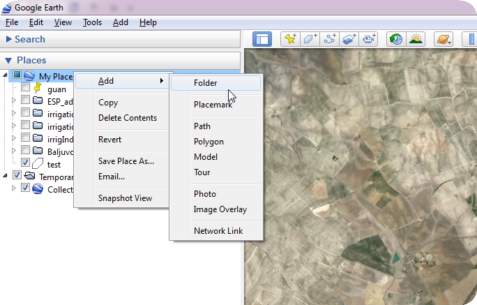
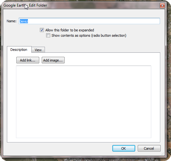
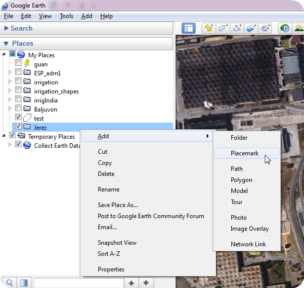
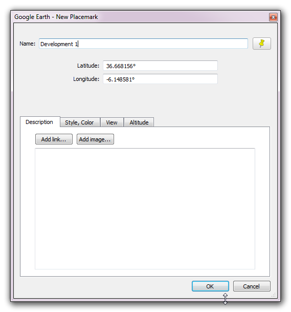
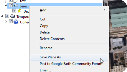
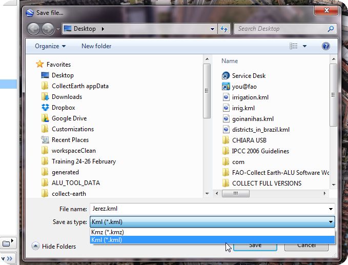
This is a very common request we get from people testing out the software.

It is quite straight forward to get Collect Earth to work on a few plots that you have previously identified. The point here is not to change the survey that is being shown on the popup but only the location of the plots shown in Google Earth.

The identification of the test points is done through Google Earth. Then these points are imported into Collect Earth and the plots would appear in these locations on Google Earth.

In Google Earth follow these steps:

  1. Right click on the "My Places" label on the left frame of Google Earth and choose Add->Folder
  2. Give the folder a name and save it
  3. Now the folder appears on the list of folders under My Places . You must now find the area where you want to use Collect Earth and set it in the center of your Google Earth screen.
  4. You need to Right-Click on the folder that you just created and then click on Add->Placemark. There is now an icon in the middle of the Google Earth window that you can move around and place it specifically where you want to test.
  5. You need to give a name to this placemark.
  6. Repeat steps 4 and 5 with as many points as you want (always in the same folder that you created in the beginning)
  7. Now you need to generate a KML file with this placemarks. Right click on the folder and now choose Save Place as... . Here it is important that you choose KML as the format to be used!!

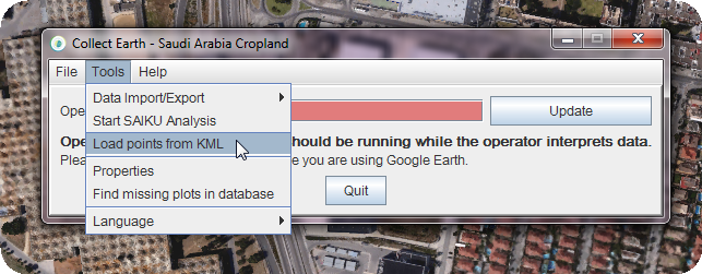
Now open Collect Earth :

  1. You need to go to Tools->Load points from KML and in the dialog that opens choose the KML file that you just generated.
  2. In the following dialog you are asked where to store the CSV with the plot location that is generated. Just choose the same folder.

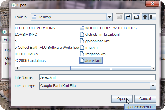
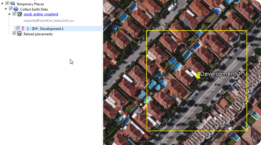
At the end you will be shown the plots in the same location than your placemarks. Click on the plots and test away!!

All the steps as images :

alt text

alt text

alt text

alt text

alt text

alt text

alt text

alt text

alt text

alt text

permanent link

answered 01 Apr '16, 15:08

collectearth's gravatar image

collectearth ♦
1.0k16
accept rate: 17%

Your answer
toggle preview

Follow this question

By Email:

Once you sign in you will be able to subscribe for any updates here

By RSS:

Answers

Answers and Comments

Markdown Basics

  • *italic* or _italic_
  • **bold** or __bold__
  • link:[text](http://url.com/ "title")
  • image?![alt text](/path/img.jpg "title")
  • numbered list: 1. Foo 2. Bar
  • to add a line break simply add two spaces to where you would like the new line to be.
  • basic HTML tags are also supported

Question tags:

×281

question asked: 01 Apr '16, 14:31

question was seen: 4,441 times

last updated: 04 Dec '17, 17:15