Sampling design: generation of the grid
Collect Earth is a sample-based tool. After identifying the scale of data collection (global/national/district/local), the sampling method for the grid has to be planned.
The grid can be created using QGIS, Google Earth Engine (via the Grid Generator application), ArcGIS, SEPAL or similar geospatial tools. We recommend to generate the grid with the Grid Generator app as explained in the following.
The Grid Generator app developed with GEE has the form of a website and offers different options to create the grid.
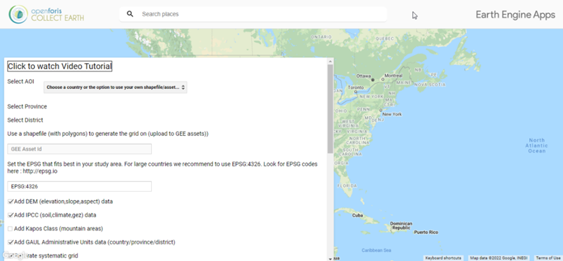
Through this app you can choose the area of interest (a predefined administrative boundary or your own AOI shapefile), the type of grid design, the distance between plots or number of plots and adding multiple other attributes to the plots that might be necessary when the data collected is to be analyzed.
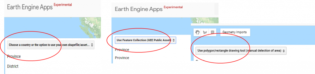
This tool allows to design and generate systematic/random grids for your Collect Earth project in a given area of interest that may be (i) a country, province or region, administrative boundary, (ii) a shapefile/polygon uploaded by the user as an asset in GEE or (iii) a drawn polygon or rectangle.
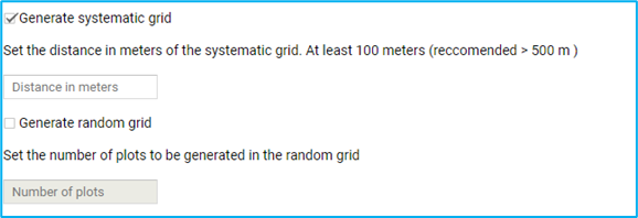
- SYSTEMATIC GRID: Set the distance between the plots in meters (will be always the same distance);
- RANDOM GRID: Set the number of plots to be generated in the random grid within the area of interest
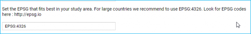
Set the EPSG code for the Coordinate System that fits best in your study area. For large countries or countries close to the Ecuador we recommend to use EPSG:4326 (WGS84). With this Coordinate System the longitudinal distance between plots changes the more you move away from the Equator. You may need to use another projection that best fits your area of interest (AOI) so that the distance between the plots on the systematic grid is constant. Find the best EPSG code for the AOI here : http://epsg.io.
- GAUL (global administrative unit layers) country/province/district information
- DEM data from SRTM-30m ( elevation/slope/aspect)
- Add IPCC ancillary data, specific for GHG inventories ( )
With this options you can augment the information contained in the grid that will be used during the analysis phase of the data collected with Collect Earth.
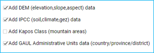
This is useful when you want to have ancillary information on the grid for later use in the analysis or for stratification.
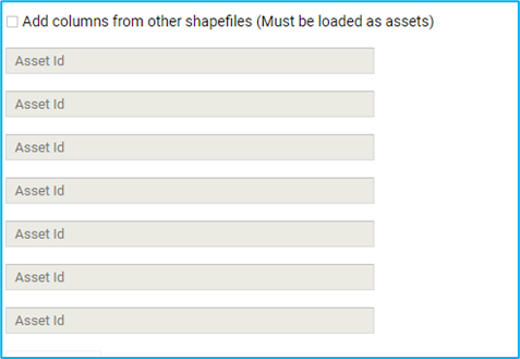
- The shapefiles must be uploaded to GEE as assets;
- This option will add all of the properties from the polygons to the intersecting plots.
Finally the user may download the grid.
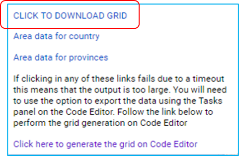
After the CSV has been downloaded, it has to be adapted to the CSV structure of the Collect Survey;
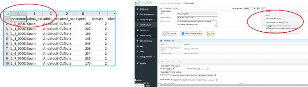
àID/ Round/ Coordinate Y/ Coordinate X…
How to find the CSV format of Collect? When you enter your survey in Collect/ Advanced functions, you can EXPORT the Collect Earth Grid Template and adjust to the GRID you already generated.
The GRID is now ready to use with Collect Earth!