

From restoration targets to measurable progress: countries advancing restoration monitoring and reporting in Nairobi
January 30, 2026
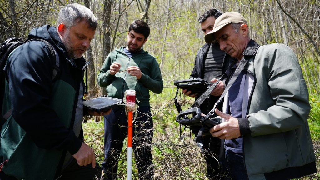
Strengthening regional capacity for restoration monitoring under GBF Target 2
February 17, 2026Authors: Pilar Valbuena, Victoria O’Brien, Till Neeff, Erik Lindquist, Andreas Vollrath, Javier Garcia-Perez Gamarra, Remi D’Annunzio, Jingjing Liang, and Julian Fox
This article was originally published here.
Across virtually all industries and fields, artificial intelligence (AI) is a transformative force. The same is true for forestry, where AI is reshaping how forests are monitored, managed, restored, and integrated into global supply chains. Early experience suggests that AI has the potential to enhance forest monitoring and to reinforce the efforts of governments and civil society alike to base decisions on stronger, more timely evidence.

What to use AI for in forest monitoring?
New and powerful approaches to working with data have already begun transforming forest monitoring. AI enables several key tasks:
- Automating labour-intensive analysis and reporting tasks.
- User-friendly and interactive decision-support systems.
- Analysing complex and diverse datasets that could not easily be integrated using conventional techniques.
Automating labour-intensive analysis and reporting tasks: Within Open Foris Whisp and EarthMap, AI enables scalable, standardised, and auditable deforestation risk analysis workflows. Open Foris Whisp has become a key operational solution for deforestation risk assessment in agricultural and forest supply chains. Through its connection with EarthMap, Open Foris Whisp now provides automated, AI-generated summaries for each point and polygon analysed, presenting the results of multi-temporal data analysis in a clear, interpretable manner to support the assessment of deforestation risk. These AI-driven summaries are translated into structured deforestation and degradation risk assessments, accompanied by compliance-oriented interpretations aligned with regulatory frameworks. This improves the efficiency of evidence synthesis and reporting, while also enhancing understanding of the analysis outputs, particularly for users with more limited technical expertise.
User-friendly, interactive decision-support systems: Chatbots powered by AI are becoming increasingly more powerful and ubiquitous. The German Agency for International Cooperation (GIZ), for example, has developed a chatbot that connects directly to Open Foris Whisp services through a conversational interface. By uploading a GeoJSON file containing farm boundaries or points, users can trigger automated geospatial analysis and receive AI-generated interpretations of deforestation risk. Such solutions enable access for non-specialized groups, including cooperatives, smallholders, Indigenous Peoples, technical agencies, and private-sector operators.
Analysing complex, diverse datasets that cannot not be easily integrated using conventional techniques: AI is also transforming forest resource assessment and inventory by enabling the analysis of complex heterogeneous datasets that are difficult to combine using conventional data analysis techniques. One example is ForestMap, which combines LiDAR, Sentinel-2 satellite imagery, and AI algorithms to support more efficient, scalable analysis of forest inventories and decision-making. By integrating three-dimensional structural data with spectral information, ForestMap can estimate forest attributes such as volume, biomass, and stand structure, and automatically generate standardised technical reports. More broadly, emerging AI approaches – including the use of foundation models and increasingly facilitating the integration of multi-sensor, multi-scale forest data by providing common analytical representations across heterogeneous inputs. These approaches support sensor fusion and large-scale analysis while complementing established inventory methods. Together, these developments represent a substantial advance for sustainable forest management, national forest inventory programmes, and carbon accounting, significantly reducing both the time and costs while improving consistency and repeatability across landscapes.
Similarly, AI enables the handling of very large datasets that would be unwieldy with traditional techniques. The MATRIX model, a collaborative effort between Purdue University, the World Resources Institute (WRI), the Science-i platform, and the Food and Agriculture Organization of the United Nations (FAO), applies growth and yield modelling techniques combined with AI algorithms to simulate forest growth and productivity at stand, national, and ecozone scales. It enables countries to project how forest resources evolve under different climatic conditions and silvicultural regimes based on national forest inventory (NFI) data. As with most modelling exercises, MATRIX benefits from increasing volumes and diversity of high-quality input data, with model performance improving as additional spatial, temporal, and ecological information becomes available. Rather than relying on a fixed minimum dataset, the approach is designed to scale with data availability and to provide estimates that are appropriate to the spatial resolution and confidence requirements of the analysis. MATRIX is in a pilot phase, but it has the potential to strengthen Measurement, Reporting, and Verification (MRV) workflows by improving the accuracy of carbon stock and sequestration estimates. Initial applications indicate that, at coarser spatial resolutions (around 3 km), MATRIX has demonstrated higher predictive accuracy than some established growth models, such as the US Forest Service Forest Vegetation Simulator (FVS), highlighting its potential value for large-scale assessments. The Ministry of Agriculture and Livestock of Peru is undertaking a pilot case for this approach, with MATRIX-Peru exploring how it can directly support national forest policy, carbon accounting, and investment planning, effectively creating a dynamic digital representation of forest landscapes.
AI-enabled simulation tools are also increasingly supporting forest management planning at operational scales. An illustrative example is SIMANFOR, an open and collaborative forest management simulator developed by the University of Valladolid in Spain. SIMANFOR combines growth and yield models, optimisation algorithms, and scenario-based simulation to support sustainable forest management decisions under different silvicultural, economic, and environmental assumptions. The platform allows users to load forest inventory data—either from field measurements, national forest inventories, or forest data collected through solutions such as Open Foris Arena, with which SIMANFOR is interoperable—and to configure management scenarios, run simulations, and analyse results through standardised outputs. By integrating scientific models with accessible digital workflows, it demonstrates how advanced analytics and with the support of AI can translate complex forest dynamics into practical decision-support tools for forest managers, researchers and public administrations, while remaining transparent, reproducible and grounded in empirical data.
Satellite embeddings, a cutting-edge application of artificial intelligence, are poised to be the next major advance in satellite-based forest monitoring by transforming complex satellite imagery into compact, information-rich vectors. This added advantage of AI allows for unprecedented efficiency in feature extraction and analysis, moving beyond traditional pixel-based methods to capture deeper contextual and spatial relationships within the data. These powerful embeddings can be seamlessly streamed through platforms like FAO’s SEPAL, enabling users to process and analyze massive, multi-temporal datasets without requiring high-end local computing resources. Furthermore, their application is critical for advanced tasks such as similarity analysis within Collect Earth Online, allowing field experts and national monitoring agencies to quickly identify and cross-validate areas with similar forest characteristics or change dynamics globally, thereby significantly accelerating visual data collection for validation purposes.

What drives adoption?
The above examples illustrate the transformative potential of AI, but how conducive is the context, and can AI realize its potential? In practice, adoption is driven by
- Data availability
- Data accessibility
- Data organization
- Institutions skills and governance
Data availability: Recent peer-reviewed research demonstrates that effective use of AI for robust, high-accuracy forest assessments requires strong datasets as its base. AI-based forest assessments achieve their highest accuracy when spaceborne LiDAR, open satellite data, and field-based observations are combined. Studies using deep learning models trained on Global Ecosystem Dynamics Investigation (GEDI) LiDAR measurements and multi-temporal Sentinel-1 and Sentinel-2 imagery show that high-resolution canopy height and forest structure maps can be produced at scale, with best performance when multi-sensor inputs are integrated, and with model quality strengthened when results are calibrated and validated using national forest inventory plots and independent field measurements. This evidence underscores a critical point: for applications that require policy-grade credibility—such as national reporting, biomass estimation, and climate finance—remote sensing outputs need systematic calibration and independent validation. Robust in situ data remain essential to ensure calibration, verification, and long-term credibility of AI outputs used for national reporting, biomass estimation, and climate finance.
Further synthesis work reinforces this conclusion. A comprehensive 2026 review published in Remote Sensing, analysing more than two decades of LiDAR-based vegetation monitoring, shows that the most significant advances now stem from the integration of multi-platform LiDAR systems with AI-driven analytics for segmentation, classification, and multi-temporal analysis. Machine-learning and deep-learning techniques substantially improve the scalability of forest structure and biomass assessments when combined with dense time series, multispectral data, and sensor fusion workflows. At the same time, the review highlights persistent limitations related to cross-sensor calibration, data harmonisation, and interoperability. It also confirms that LiDAR- and AI-derived forest metrics achieve their highest reliability only when anchored in robust field protocols and national forest inventory data. Taken together, this evidence reinforces a central principle: while AI can significantly enhance forest monitoring capabilities, its credibility and policy relevance ultimately depend on open data frameworks, transparent methodologies, and systematic field-based verification.
Innovative approaches are also emerging to build large forest monitoring datasets that enable effective AI at scale. Community-built commodity models rely explicitly on AI and machine learning (ML) to support deforestation-free supply chains. Under the auspices of the Forest Data Partnership (FDaP), Google released openly licensed ML community models and corresponding global maps that depict, at high spatial resolution, the likelihood of palm oil, cocoa, rubber, coffee, and cacao; all key commodities impacting forest change. These are not simple thematic maps; they are the output of a repeatable ML pipeline combining cloud-scale geospatial processing with modern supervised learning techniques trained on contributed reference data and multi-sensor Earth observation inputs. Their distinctive value lies in the iterative learning loop: as more validated training and validation data are contributed by partners, models can be retrained and the probability layers updated, enabling accuracy to improve over time.
Data accessibility: Forest monitoring datasets may often exist, but leveraging AI requires them to be open and, preferably, linked. In Spain, the open national LiDAR coverage provided through the PNOA-LiDAR programme and the long-standing National Forest Inventory (NFI) constitute an exceptional example of how open linked forest data can contribute to the development of digital public infrastructure and small private enterprises. Together, these datasets provide three-dimensional forest structure, biomass proxies, species composition, and long-term forest dynamics, and serve as high-quality training and validation data for AI models.
Data organization: For AI to develop its full potential, interoperability and open standards are essential to ensure that platforms such as Open Foris Whisp, Earth Map, and national monitoring systems can exchange data seamlessly. For example, Indonesia’s National Forest Monitoring System, SIMONTANA, provides a relevant illustration of how organised data architectures enable effective use of advanced technologies. SIMONTANA integrates remote sensing and terrestrial data within a single institutional platform, combining satellite imagery, LiDAR, national forest inventory plots, and field verification into a structured workflow that supports forest planning, deforestation and degradation monitoring, fire management, peatland inventory, and mitigation actions.
A similar logic underpins Brazil’s long-standing forest monitoring architecture, developed by the National Institute for Space Research (INPE). Systems such as PRODES and DETER, accessible via Terrabrasilis, illustrate how well-organised, standardised, and interoperable data infrastructures can sustain large-scale forest monitoring over decades. Their institutional and technical coherence enables downstream analytical innovation, including the integration of advanced modelling and AI-based tools, without compromising transparency, traceability, or national ownership of data. In both cases, Open Foris Whisp is already integrated as an interoperable component, enabling the use of national monitoring data to support deforestation risk analysis for commodity production.
More recently, Brazil is also advancing towards integrated, cross-sectoral data platforms that connect forest monitoring with agricultural policy and financial decision-making. The AgroBrasil+ Sustentável (AB+S) Platform, launched in 2024 by the Ministry of Agriculture and Livestock, consolidates authoritative environmental and production data from official sources to support risk-informed credit analysis and promote sustainable agricultural practices. New modules under development include deforestation risk assessments designed to support compliance with international requirements. Within the framework of AIM4Forests and AIM4Commodities, FAO and the Ministry of Agriculture and Livestock have identified strong complementarities between AB+S and Open Foris Whisp and have been working since 2025 to integrate Whisp’s geospatial risk analysis capabilities into the platform. This collaboration illustrates how organised national data systems can be extended through interoperable solutions to serve emerging regulatory, financial, and sustainability needs, while preserving institutional roles and data sovereignty.
Data manageability: Beyond data integration and system architecture, effective use of AI in forest monitoring ultimately depends on the capacity of institutions and professionals to interpret, validate, and act upon results.
Experience from several countries illustrates this clearly. For example, in Indonesia, SIMONTANA is not only a technically integrated platform but a system embedded in day-to-day government operations, supported by trained technical teams, standard operating procedures, and long-standing institutional memory. Its outputs are routinely used for forest planning, enforcement, national reporting, and climate mitigation targets, demonstrating how sustained capacity enables continuity and learning over time. In Brazil, the sustained operation of INPE’s monitoring systems reflects a similar investment in specialised analytical capacity and methodological rigour.
Together, these experiences underline that AI and advanced analytics generate value only when they are embedded within strong institutional frameworks and supported by appropriate skills and governance arrangements. In practice, this requires that data are interpreted, validated, and used by qualified professionals within stable organisations, and that capacity development, transparency, and continuous improvement are treated as long-term public investments rather than one-off technological deployments.

What to be aware of
AI has considerable potential to bring forest monitoring to the next level, offering significant performance gains and new analytical capabilities. These emerging technologies offer an opportunity to reinforce efforts of governments and civil society alike to build more robust evidence as a basis for better decision-making, reduce deforestation, and improve sustainable forest management.
For FAO, the central challenge is not simply to accelerate the uptake of AI, but to ensure that its deployment strengthens national sovereignty over forest data, supports inclusive development, enhances regulatory integrity, and delivers measurable benefits for climate action, biodiversity conservation, and rural livelihoods. This analysis reflects the principles and priorities set out in FAO’s Digital Agriculture and AI Innovation Roadmap for the responsible use of artificial intelligence based on mission-driven applications, data interoperability, capacity development, and national data sovereignty.
Realizing AI’s potential to transform forest monitoring requires a conducive environment. Collaboration is needed among governments, international organisations, the private sector, and the scientific community. The AIM4Forests programme aims to support and accompany these efforts, promoting the use of AI in forest monitoring where it adds clear value and where practical opportunities exist. 
To know more about how artificial intelligence and open digital infrastructures are being applied in forest monitoring and sustainable forest management, the following resources provide further technical detail and practical examples:
- Forest Monitoring and Data Platforms team – FAO’s Forestry Division team advancing innovative, inclusive, and data-driven approaches to strengthen forest monitoring, decision-making, and sustainable forest management worldwide https://www.fao.org/forest-monitoring
- AIM4Forests – FAO programme supporting countries in strengthening forest monitoring data systems, and digital public infrastructure https://www.fao.org/in-action/aim4forests
- Open Foris – FAO’s suite of free and open-source solutions supporting national forest monitoring systems, and data-driven decision-making https://www.openforis.org
- Forest Data Partnership (FDaP) – Community-driven initiatives and open models supporting deforestation-free supply chains https://www.fao.org/transparent-supply-chains/forest-data-partnership/en
This article was originally published here.